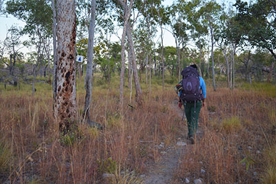
An extensive guide to hiking the Thorsborne Trail
Hinchinbrook Island (or Munamudanamy to the Bandjin and Girramay people), located off the coast of North Queensland, is one of Australia’s largest island national parks. Discover what it’s like to hike the island’s renowned Thorsborne Trail.
Imagine spending a handful of days on a remote island, off the coast of Far North Queensland. Sounds like a dream, amirite?
Well, hike the Thorsborne Trail, located on Hinchinbrook Island, and you’ll do just that.
This island has it all – rainforest, white beaches, jagged mountains and roaring waterfalls. And crocodiles, but don’t let that deter you…
While this hike is only (only!) 32 kilometres, it’s quite difficult to traverse in some places, and requires a good level of fitness.
However, it’ll probably be one of the most rewarding trails you’ll ever step foot on.
I had the pleasure of spending six whole days on this island, the maximum amount of time you can spend undertaking this walk.
And while it was a thoroughly challenging hike at times, thanks to both the terrain and the weather, I’m extremely glad to have trekked this phenomenal trail. It’s got to be one of the best in Australia.
Let’s dive deep, exploring everything you need to know before attempting this hike yourself. How to book, what to bring and what to expect… it’s all covered.

This post may contain affiliate links. I may make a small commission if you make a purchase through this page.
A complete guide to hiking the Thorsborne trail
History of and facts about the Thorsborne Trail
This 32-kilometre trail is renowned for its beautiful (and can I just say somewhat challenging) terrain.
It’s named for Australian naturalists and conservationists Arthur and Margaret Thorsborne. As part of their extensive environmental efforts, the couple monitored pied (Torresian) imperial-pigeons, which migrate to nest on this island in summer.
The trail runs from Ramsay Bay in the north, to George Point in the south, although it’s possible to hike it in either direction. Most hikers do tend to start from Ramsay Bay.
Some other points worth noting:
- The ancient Biyay name for the island is Munamudanamy and it’s part of the traditional lands of the Bandjin and Girramay peoples.
- The island is one of Australia’s largest national parks.
- On the trail you’ll get up close to two dramatic waterfalls – Zoe Falls and Mulligan Falls.
- Along with a diverse range of wildlife, the island is home to – gulp – estuarine or saltwater crocodiles, also known as salties.
- As a marine park, there are opportunities to see sea life, along with endangered wildlife on the island itself.
- Being separate from the mainland, it’s completely remote and you may hike all day without seeing another soul.
Why hike the Thorsborne Trail?
Before I embarked on this walk, I heard from several people that this was their top hike. Yes, their most favourite hiking experience, ever. Some had even returned to do the hike, multiple times.
If that’s not a ringing endorsement, I don’t know what is.
The Thorsborne Trail was my second ever multi-day hike (the first being the fantastic Jatbula Trail). Two very different hikes, even though they exist in the same country.
If you love a challenge and wish to experience a diversity of trails within the one setting, then you’ll love the Thorsborne Trail. I’m not sure whether I’d recommend it for your second multi-day hike ever, but hey – I survived it!

How to get a permit for the Thorsborne Trail
Twelve permits are available per day, throughout the hiking season. The largest group booking permitted is six.
You’ll need to book a permit directly through the Queensland National Parks booking service.
Once there, you can select your hiking start date and desired number of nights/days.
It’s an offence to camp on the trail without a permit, and outside your nominated dates.
Note: Thorsborne Trail permits for 2026 will be released on 16 December 2025 at 10am (Queensland time). Pop it in the diary!
How long does it take to hike the Thorsborne Trail?
Unlike other multi-day hikes in Australia, there’s no set length of time you must complete this hike in.
If you’re short on time, you can choose to complete the trail in three days and two nights, staying at Zoe Bay and Mulligan Falls.
Other options include four days and three nights, five days and four nights and if you really want to stretch it out, six days and five nights (which is what I chose, no regrets).
I recommend spending at least three nights on the island, to make the most of the experience.
When is the best time to hike the Thorsborne Trail?
Officially, the Thorsborne Trail is open from 1 March to 31 December each year.
However, the best time to complete this hike is during Australia’s cooler months, roughly from April to September.
For comfort and the most predictable weather, I recommend trying to book for anywhere between June-August.
This hike is located in the tropics, which is fairly predictably wet in the summer months of December to February and unpredictably wet for the rest of the year.
Make sure you pack accordingly – more on this below.
Cost to hike the Thorsborne Trail
The Thorsborne Trail is relatively inexpensive to book, compared to other premier hiking trails in Australia.
As of 2025, the prices are as following (per person):
- 3 days/2 nights: $15
- 4 days/3 nights: $22.50
- 5 days/4 nights: $30
- 6 days/5 nights: $37.50
This covers the permit. You’ll also need to consider the cost of getting there.

Getting to the Thorsborne Trail
If you’re not local to the Far North of Queensland, you’ll need to make your way to Cairns or Townsville.
From yhere, you can rent a car and drive to the towns of Cardwell or Lucinda.
The distance from Cairns to Cardwell is 183 kilometres, which would be around a 2 hour, 15 minute drive without stopping.
Townsville to Lucinda is a much shorter drive, at 135 kilometres, which takes around 1.40 hours from A to B.
Noting any rental car will probably need to be left in a car park overnight. If you don’t feel comfortable with this, you may want to transfer by shuttle bus, or book onto the Greyhound bus service.
I flew in and out of Cairns and opted to book the Greyhound. The bus leaves from Cairns Railway Station, which is around a 10 minute drive from the airport.
There’s no Greyhound route between Townsville and Lucinda, but local operator Absolute North Charters does offer a shuttlebus service.
In fun times, my flight from Melbourne to Cairns was delayed by almost five hours, which meant I missed my pre-booked bus. We ended up scoring a ride via Uber to Cardwell, thanks to a visitor to the area who was keen on earning while he explored.
A reason to consider travel insurance, even when travelling locally! I always book insurance when undertaking a multi-day hike in a remote location.
Getting from Lucinda or Cardwell onto Hitchinbrook Island
There is a boat charter service operating out of both towns.
If you’re heading to the island from Lucinda, you’ll need to book a return transfer with Absolute North Charters.
Those landing on the island from Cardwell can book with Hitchinbrook Island Cruises.
I had the pleasure of meeting both operators during my time in this part of Queensland and they were both highly knowledgeable and friendly.

Food and water on the trail
Each campsite has some sort of access to clean water, although in some cases, it might be a further hike of ten to twenty minutes.
I very much recommend filtering or boiling water before consuming it. I can’t think of anything worse than getting gastro while hiking in a remote location.
Make sure you fill your hydration bladder and water bottle right up before you leave each campsite.
There are no drop-off points for food – when hiking the Thorsborne Trail, you’ll have to carry everything you plan on eating with you.
Please pack a garbage bag and take all your rubbish with you.
Another piece of advice. Avoid eating in your tent and use the racks for your packs.
Hinchinbrook Island is home to giant white-tailed rats, which can and will chew through your bag or tent in search of food. I came face to face with one such wily creature trying to get in one night. They’re cute, but hungry.

What to pack for the Thorsborne Trail
And probably the most important consideration – what should you pack for hiking the Thorsborne Trail?
The essentials
- Lightweight hiking tent
- Sleeping bag
- Sleeping bag liner
- Ultralight pillow
- Self-inflating mattress
- 3L hydration bladder
- Lifestraw bottle
- Head torch
- Osprey 65L backpack
- Personal Location Beacon (PLB)
- Dry bags
- Waterproof poncho
- Tarp
Other gear
- First aid kit
- Snake bandage
- Sunscreen
- Aloe vera
- Toilet paper and pee rag
- Hand sanitiser
- Lipbalm (SPF15)
- Electrolytes
- Garbage bag
- Fast-drying towel or sarong
Clothing
- Hiking pants or leggings
- Shorts
- Gaiters
- Fly net
- Hat
- Sunnies
- Hiking boots
- Merino shirt
- Merino socks
- Sports bra
- Fast-drying underwear
- Bathers/swimmers/cozzie
- Hanky
Food and cooking
- JetBoil stove
- JetBoil fuel (available for purchase in Cairns or Townsville – we bought ours directly from Hinchinbrook Island Cruises)
- Emergency matches
- Cup
- Plate
- Spork
Optional (but recommended)
- Hammock
- Hiking poles
- Knife
- Powerbank
- Nature journal
- Pen
- Camera
- Kindle or book (see my list of books about walking, if you want to stay on theme).

The Thorsborne Trail itinerary: day-to-day
Here’s an account of hiking the Thorsborne Trail, to give you a bit of an idea of the day to day. For more, read my personalised field notes from the trail.
Day one: Cardwell to Ramsay Bay (by boat), then Nina Bay – 4kms (optional)
Day one will see you dropped on the shore of Ramsay Bay, to begin your journey. It’s just under an hour’s cruise from Cardwell to this point, particularly enjoyable if you love boats as much as I do.
You have two options, depending on how much time you’ve chosen to spend on the island.
You can either walk through to Little Ramsay Bay, which is the more popular option.
Or, you can spend the night at Nina Bay. You’ll most probably have the campsite to yourself.
Fresh water is located a bit of a walk from here, taking around ten minutes for the round trip.
There’s an opportunity shortly before the first camp to leave bags at the base of Nina’s Peak and climb on up. Your reward upon reaching the top is panoramic views of the island.
Day two: Nina Bay to Little Ramsay Bay – 2.5kms
If you’ve chosen to spend the night in Nina’s Bay, it’s only 2.5 kilometres to the next camp.
This is however, a somewhat challenging stretch, including rock scrambling around the headland and the climbing of a ‘small cliff’.
You’ll then pick your way along the aptly named ‘Boulder Bay’, which is indeed, a bay filled with rocks and boulders.
Then you’ll weave inland, to cross dry creek beds, eventually emerging onto Little Ramsay Bay, the next campsite. This is definitely one of the nicest ones on the trail.
The campsite is off from the beach, right next to a big lagoon, which looks nice but is labelled with bright yellow signs that state: ‘Warning! ACHTUNG!’ and feature pictures of crocs.
The threat is clear in any language.
You’ll have to head about twenty minutes inland to locate fresh water. Fill up your bottle and bladder, ahead of the longer trek tomorrow.

Day three: Little Ramsay Bay to Zoe Bay – 10.5kms
The longest part of the walk will see you threading through amazing rainforest and crossing many a creek. Take your shoes off for the deep ones, less you wish to get your feet soaked.
First, you’ll scramble around the headland. No small cliffs today, but there are a couple of instances that require a bit of mental rallying.
After the rainforest, you’ll emerge into a muddy swamp. Do your best to not sink too deep.
Finally, you’ll arrive at Zoe Bay. The largest campsite, it has options to camp either by the beach, or in the forest.
Day four: Zoe Bay – 0kms
If you’ve opted for an extra day (or walked through Nina Bay), you’ll have today to rest and recuperate at Zoe Bay.
Zoe Falls is around a ten minute walk from camp. Here you can wash clothes, laze around or go for a dip. Bring your goggles, in order to see the fish that live at the base of the falls.
You can also climb to the top of the falls, for a view over the island. You will have to do this tomorrow in any case, but it can be fun to do without a pack.

Day five: Zoe Bay to Mulligan Falls – 7.5kms
From Zoe Bay, you’ll make your way to Mulligan Falls.
You’ll need to head back out to Zoe Falls and climb to the top. Part of this effort will require the use of a rope against flat rock. You’ve got this.
Enjoy breakfast at the top of the falls, maybe even watching the sunrise, as we did. Optional – take advantage of the small pools of water and lack of salties to take a quick dip!
This is the section with the most elevation and there’ll be a lot of up and down and up and down across dry and wet creeks.
Some of the rocks within the rainforest are quite mossy and so, slippery. Watch your step.
At the top of the peak, you’ll enjoy views out to the Palm islands and Magnetic Island, alongside the nearby town of Lucinda, if it’s a clear day.
Once at camp, you can cool off at the base of Mulligan Falls.
Day six: Mulligan Falls to George Point – 7.5kms
You’ll be walking to time at this point of the hike, for your designated pick up at George Point.
You’ll enjoy a little walk through rainforest and several creek crossings, before emerging onto the beach.
Your last challenge is the crossing of an estuary. You need to time it right with the tides, so visibility is good.
Maybe sit and have breakfast while you wait for the tide to recede.
Once you have good visibility, make your way across the estuary and head to the pick up point, for your boat ride back to either Lucinda or Cardwell.

Can you hike the Thorsborne Trail solo?
While it is possible to hike the Thorsborne Trail solo, it’s definitely one I’d recommend sharing with a group, or a friend.
It’s a fairly challenging hike, which is recommended for experienced hikers, after all.
If you are planning on heading to the island alone, make sure you have a Personal Location Beacon (PLB) in easy reach. They are critical for a solo hike.
You may want to carry a GPS device, as well as a map. There’s very little phone reception on the island.
And make sure someone knows your expected departure and arrival times.
How to prepare for the Thorsborne Trail
This is a challenging hike. Not the hardest you may ever do, but certainly challenging.
A sound degree of fitness is expected, when tackling this trail.
Part of the trail involves climbing up a small cliff, and scrambling up a rockface, by rope. There is also a lot of picking your way over rocks on headland and over creek crossings.
The weather in this part of Australia can be a bit finicky, too.
I hiked the trail in June, with temperatures in the early to mid twenties (celsius) by day. At night, they dropped to around 15°C, which is manageable with a decent sleeping bag.
However, it did rain quite a bit. I recommend packing wet weather gear such as dry bags for clothes, food and electronics, a poncho to walk in and a tarp for your campsite.
Navigating the Thorsborne Trail
You don’t need to have top-notch orienteering skills to complete this trail.
There are markers along its path, although sometimes they’re a bit further spaced out than I would have liked.
I thoroughly recommend bringing a paper map along with you, to refer to as you go. A print out of the tide timings will also be invaluable.
I was definitely on the slow side, staying either on or out of the edge of the recommended hiking times. A slight blow to the ego, but whatever.
Having been on the fence regarding hiking poles in the past, I definitely recommend them for this trail. They’ll prove invaluable in getting across rocky beaches and creek crossings.

Staying safe on the Thorsborne Trail
Hitchinbrook Island is located in crocodile country and yes, is home to many a crocodile.
Estuarine crocodiles are often known as saltwater crocodiles, although this is a bit of a misnomer, as they can live in fresh or saltwater. All the better to eat us, I guess.
These big guys are predators and it seems like everyone in Cardwell had some story about someone they knew getting mauled or killed by a crocodile, which was entirely unpleasant to hear.
THAT BEING SAID – I didn’t see a single croc during my time on the island, for which I am very thankful, as they scare the bajeebers out of me.
There are two official swimming spots that are safe to enter, which are at the base of both Zoe and Mulligan Falls. There’s another spot known as the Blue Lagoon, which is also allegedly swimmable, although we didn’t find it, and so didn’t go swimming in it.
The lagoons that are not accessible, will generally have signs saying ‘Warning! Crocodiles’ on them, so you’ll definitely know that swimming in these bodies of water is a poor life choice.
Likewise, please stay well away from the ocean’s edge.
As there are many creek and estuary crossings, time your hike to the tides. We had a printed guide, which was very helpful to refer to.
Here are a few other general tips for staying safe on this trail:
- Stay on path and follow the trail markers.
- Make sure you carry at least three litres of water on you while walking, and keep hydrated throughout the day.
- Purify all water in some way.
- Ensure you have a robust first aid kit and some way to contact the outside world.
- Keep an eye out for wildlife – if you do encounter them, leave them be.

Where to go after hiking the Thorsborne Trail
There are so many options for your onward journey, after hiking the Thorsborne trail.
You could spend a few days in Townsville, before heading over to Magnetic Island, to explore.
From Cairns, you could go see the Great Barrier Reef, or take the Skyrail Cableway to Kurunda and hop on the scenic railway from there.
You could also head to Port Douglas and onto the Daintrees.
Queensland has heaps to offer the curious traveller.
So there you have it – a complete guide to hiking the Thorsborne Trail on beautiful Hinchinbrook Island.
It’s definitely a must-do if you’re a keen hiker and fan of Australia’s diverse flora, fauna and landscapes.
Have you hiked Hinchinbrook Island? Would you like to? Anything I’ve missed? Let me know in the comments.
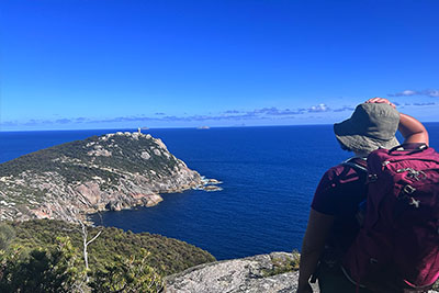
An overnight hike to the Lightstation in Wilsons Promontory
20 amazing road trips in Australia

Prices are correct at time of writing.
The Thorsborne Trail is located on the lands of the Bandjin and Girramay peoples. I acknowledge them as Traditional Owners and pay our respects to their Elders, past and present.